Three ways to buy a view of the Earth
Planet Monitoring is the daily scan sold as a subscription. Customers get near-daily 3.7 m imagery of all of Earth's landmass through APIs, a web application and GIS integrations, sized to the area and analysis they need. Its historical imagery supports comparisons through time. Because one image can be sold many times, a single pass can in principle serve a forestry agency, a crop analyst and a defense ministry. Buyers range from national agencies to companies such as BASF, which Planet says uses analytics from its near-daily imagery to help growers keep yields while using crop protection products more efficiently. Monitoring stands in for site visits and aircraft when the area is wide.
Planet Tasking is the close look on request. SkySat and Pelican satellites photograph a chosen place at 50 cm, and Planet says images and insights arrive less than four hours after capture. Customers either order through the Planet Select portal and pay as they go, or use a Tasking Dashboard with tasking credits for steady, integrated work. The Tasking page also describes access to an Earth-data archive of approximately 50 PB. Pelican is the new generation: it entered general availability for eligible customers in December 2025, carries six multispectral bands and an NVIDIA Jetson processor, and ten high resolution Pelicans were on orbit after a July 2026 launch. A 30 cm class second generation is planned. The January 2026 operational review describes 50 cm class imagery; the current product page lists 30 to 50 cm class capability. Applicants should distinguish those descriptions and the planned second-generation capability.
Planet Insights Platform is where both kinds of data live, a cloud platform for daily Earth data and analytics. On top of it sit analytics for defense buyers, such as automated vessel recognition and tracking at sea and monitoring of military installations and critical infrastructure, and a new agentic AI app that was free while in beta in August 2026. The AI app is the product form of what Marshall calls a queryable Earth: a user asks a question in plain language and the archive answers.
The fourth product is a satellite a country owns
Since January 2025 Planet has also sold its factory. In satellite services a government or partner funds a set of Pelican satellites that Planet builds and runs, with capacity reserved for that customer and operating services on top. The first was the largest contract in the company's history, $230M over several years with a long standing Asia Pacific partner, Japan's SKY Perfect JSAT. Germany followed in July 2025 with a EUR 240M multi-year agreement funded by its government for dedicated capacity and direct downlink over European regions, and Sweden in December 2025 with a low nine-figure deal under which its armed forces own the satellites. Planet counts more than $500M signed across the three in about twelve months, and pitches the model as a cheaper, lower risk and faster route to space capability than a nation building its own system.
Europe needs its own eyes
Will Marshall · Co-founder and CEO · Planet release on the Sweden agreement, as reported by trade press · 2026-01-14
What one customer measured, and what others bought
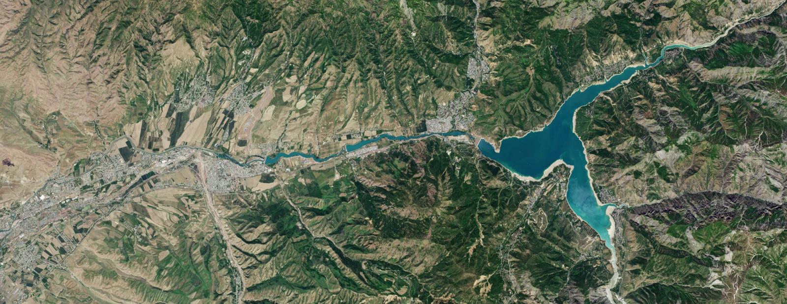
The clearest before and after comes from Uzbekistan. Uzcosmos used to watch reservoirs with field inspections, staff gauges, scattered reports and paper records. It then fed near-daily 3 m PlanetScope imagery into its own GIS platform to build virtual gauges over more than 50 reservoirs at once. Checked against a ground sensor from July 2024 to April 2025, the satellite water level stayed within about 10 cm under validation conditions. Planet reports the result in a September 2026 case study, with one reservoir used for the comparison.
This significantly increased confidence in using satellite intelligence for national-scale water management.
Mukhiddin Ibragimov · Deputy Director, Uzcosmos (customer) · Planet case study · 2026-09-30
Most other named customers are governments buying access for many users. In Germany, the federal mapping agency BKG gives more than 400 federal institutions access to Planet data, a partnership renewed and expanded in the quarter to January 2026. Rwanda's space agency launched a national program in June 2026 that feeds Planet imagery to ministries, public universities and selected startups for farming, forest and urban planning work. The US National Geospatial-Intelligence Agency awarded $8M in August 2026 to deploy Planet's Global Monitoring Service, and Marshall says the US Navy uses Planet to monitor developments in the South China Sea.
The government examples show different kinds of evidence. Uzcosmos reports a comparison against a ground sensor at one validation reservoir; German and Rwandan announcements describe access, contract scope and intended uses. Signet reads that distinction as useful preparation for Korea: an adoption or renewal case should state what the agency actually measured, which users adopted the workflow and what mission result was observed. The customer-success posting makes leadership-visible KPIs a core responsibility.